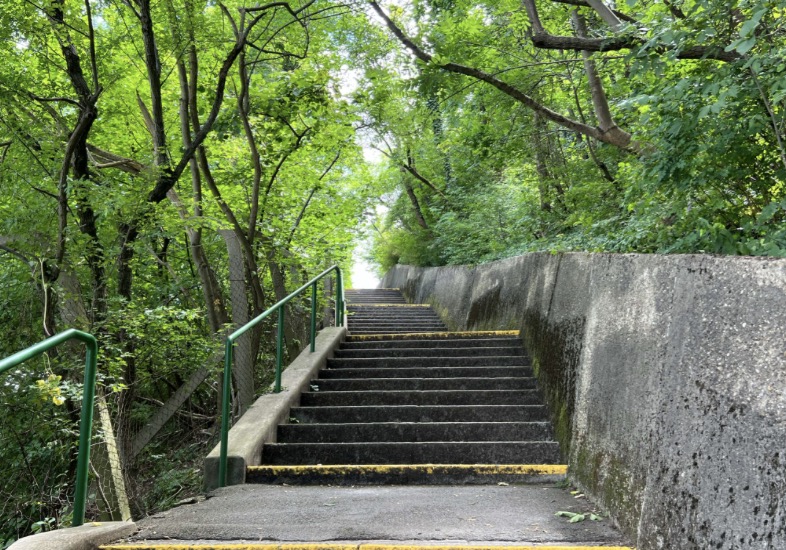
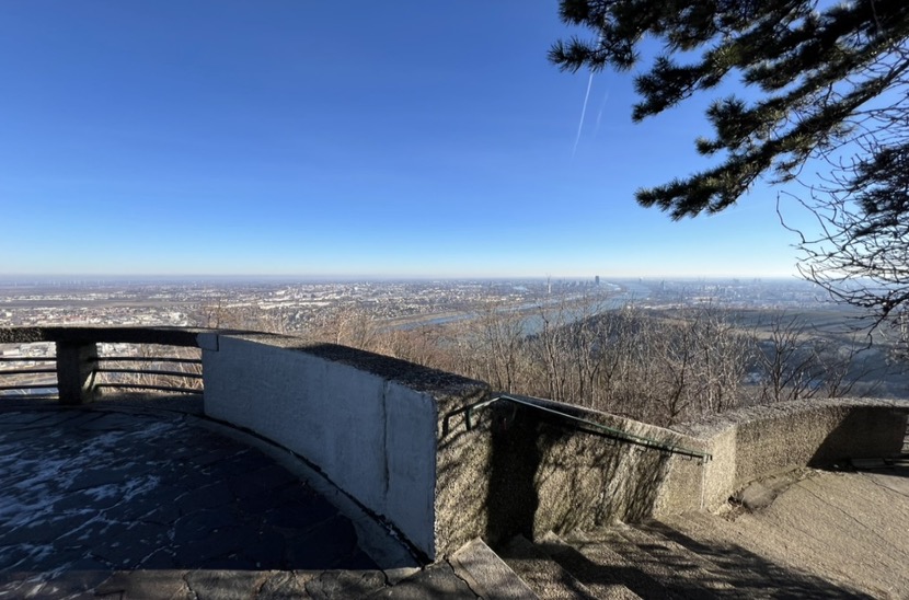
The so-called Nasenweg connects Kahlenbergerdorf with Leopoldsberg. The name can be traced back to the steeply sloping edge of the Leopoldsberg that is known as the ‘Nase’ (nose). The footpath is around 1.5 km in length and rises 250 m.[1] The paved path incorporates a number of viewing platforms that are connected by ramps and steps. It begins at the Waldbach in Kahlenbergerdörfl and ends, 12 hairpin bends higher, at the Aussichtskanzel (the pulpit with a view) on Leopoldsberg. The dilapidated path is being adapted in a contemporary manner and restructured in the form of a thematic trail. A new station for ramblers and visitors that can be used for both exhibitions and seminars will be built on the plateau on Leopoldsberg. This plateau also marks the most northerly point on the Höhenstrasse before the River Danube interrupts the main ridge of the Alps at the gateway to Vienna.[2]
Location
The fortress on Leopoldsberg dates from the 12th century and was rebuilt in 1794 following a fire. The Nasenweg, which connects the fortress with Kahlenbergerdorf, was created at the same time and realigned in 1936 during the construction of Vienna’s Höhenstraße. The funicular railway on Leopoldsberg that was built to mark the 1873 Vienna World’s Fair was dismantled in 1875.[3] An access to Leopoldsberg was incorporated into the Höhenstraße (built 1934–38).[4] The fortress has belonged to Klosterneuburg Abbey since 1787 and was used as a restaurant by day-trippers until it had to close due to its lack of infrastructure (water, drainage, electricity) in 2007. The new tenant plans to renovate the restaurant and reopen it as a wedding venue with exhibition spaces.[5] St. Leopold’s Church has been accessible again since 2018.[6] Today, the fortress is largely surrounded by site fencing and inaccessible to the general public.
Objective
The Nasenweg will be developed as a contemporary thematic trail that meets the needs of all users. The starting point in Kahlenbergerdorf will be upgraded and one station on Nasenweg will be developed as a viewing platform and incorporated into the existing footpath network. A station will be created on the plateau on Leopoldsberg that will highlight this plateau as a meeting point at the end of the Höhenstrasse and as the starting point for the descent of the Nasenweg. The station should be used for exhibitions and refreshments for day-trippers as well as for seminars and retreats.
(1) de.wikipedia.org/wiki/Nasenweg
(2) alpenpaesse-wasserscheiden.at
(3) geschichtewiki.wien.gv.at/Leopoldsberg
(4) geschichtewiki.wien.gv.at/Leopoldsberg
(5) Wiener Zeitung: Ärger um gesperrten Leopoldsberg
(6) Der Standard: Burg am Leopoldsberg wird für Wiedereröffnung saniert
Methods:
Starting with a spatial analysis of the location and the existing situation and research into selected examples, you will develop a concept for reinterpreting the path and its stations. You will work in teams, developing basic plans and spatial analyses in order to record the existing and process this initial information. You will develop an innovative and needs-based spatial programme that is derived from the spatial situation on the ground. Your objective for this spatial programme is that it facilitates and encourages movement and relaxation, communication and collective exchange. It could include, for example, quiet islands, service providers for ramblers, restaurants for day-trippers, places for sport and movement, temporary spaces for special events and exhibition spaces.
You will develop a selected area in detail. This design work will be organised in sections and pass through various scales.
The project will be developed with the help of physical models.
The project is an integrated project for bachelor and master students with special activities in the areas of scenography, construction and landscape.
Scenario
You will develop a scenario for a range of users of these public spaces and plan strategies for communicating selected subjects on the Nasenweg and at the station on Leopoldsberg.
Construction
You will design the structurally significant loadbearing elements of the project in detail. These could include temporary roofs, platforms, retaining walls, walkways, bridges or steps. Structural variants should be designed and investigated, with a focus on issues such as bracing, dimensioning and assembly.
Landscape
The transformation of public spaces is also accompanied by the development of areas of greenery. Water management, the planting of trees and protection against large volumes of rainfall are changing our green spaces, impacting upon the microclimate and increasing biodiversity. Green spaces are an integral part of the public realm. In such places, in which many interests collide, fair distribution plays an important role because public spaces should be open to all.
Special activities
The following special activities are offered to consolidate the subjects of the project
Exercises in the spatial laboratory LV253.G73 4ects.
Excursions LV 253.365 2ects.
Exchange with a wide range of interest groups will be encouraged. This type of cooperation intensifies discussion and promotes a climate of exchange and collaboration. We are looking for engaged students, who are prepared to address both the realities of architectural practice and visions of the future. By getting to know a range of perspectives and preparing in this way for your future professional work you will be able to gain experience and sound out your future profession.
Exhibition and publication
The projects will be presented to the public. A publication will document these projects. Discussion encourages the investigation of concrete issues.
Lecturers:
Anton Kottbauer
Norbert Trolf
Günter Pichler
Kamyar Tavoussi
further information:
Kick-Off: Thu, October 3rd, 2024, 10.00.
Meetings every Thursday 09:00 – 18:00.


